|
150-300: supercell development
possible with large CAPE, risk for weak tornadoes
(F0, F1)
300-450: supercell development possible with small
CAPE, risk for strong tornadoes (F2, F3)
>450 : large risk for supercell development,
risk for violent tornadoes (F4, F5) source:www.theweatherprediction.com
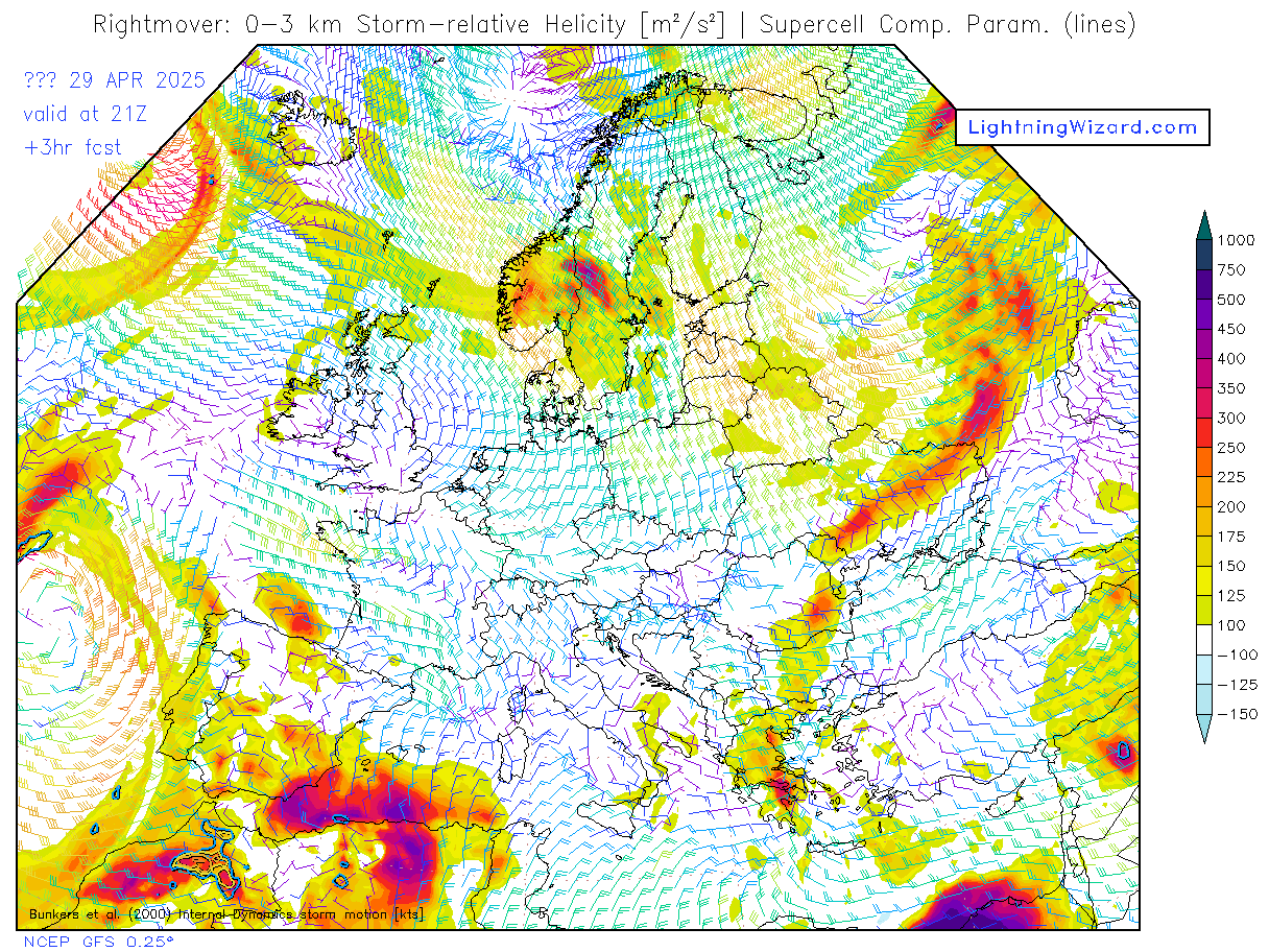
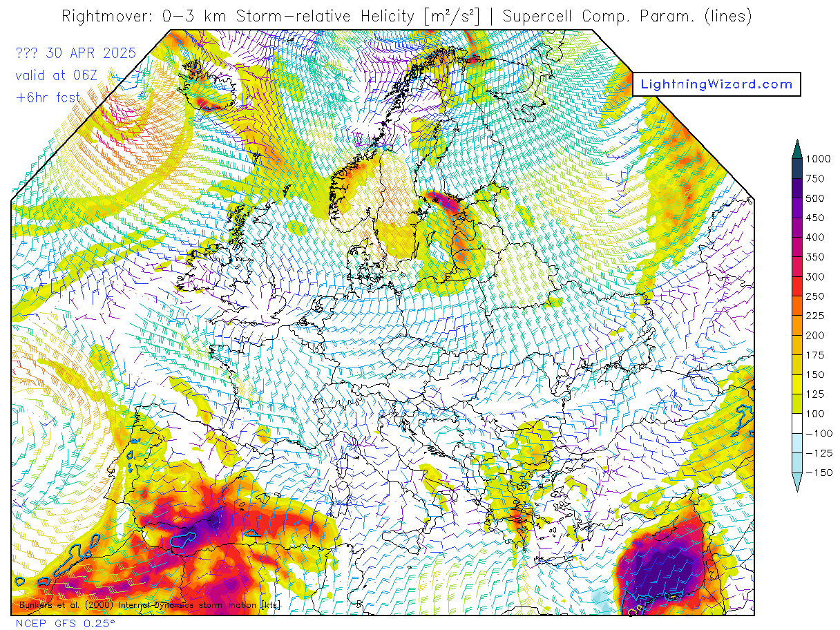
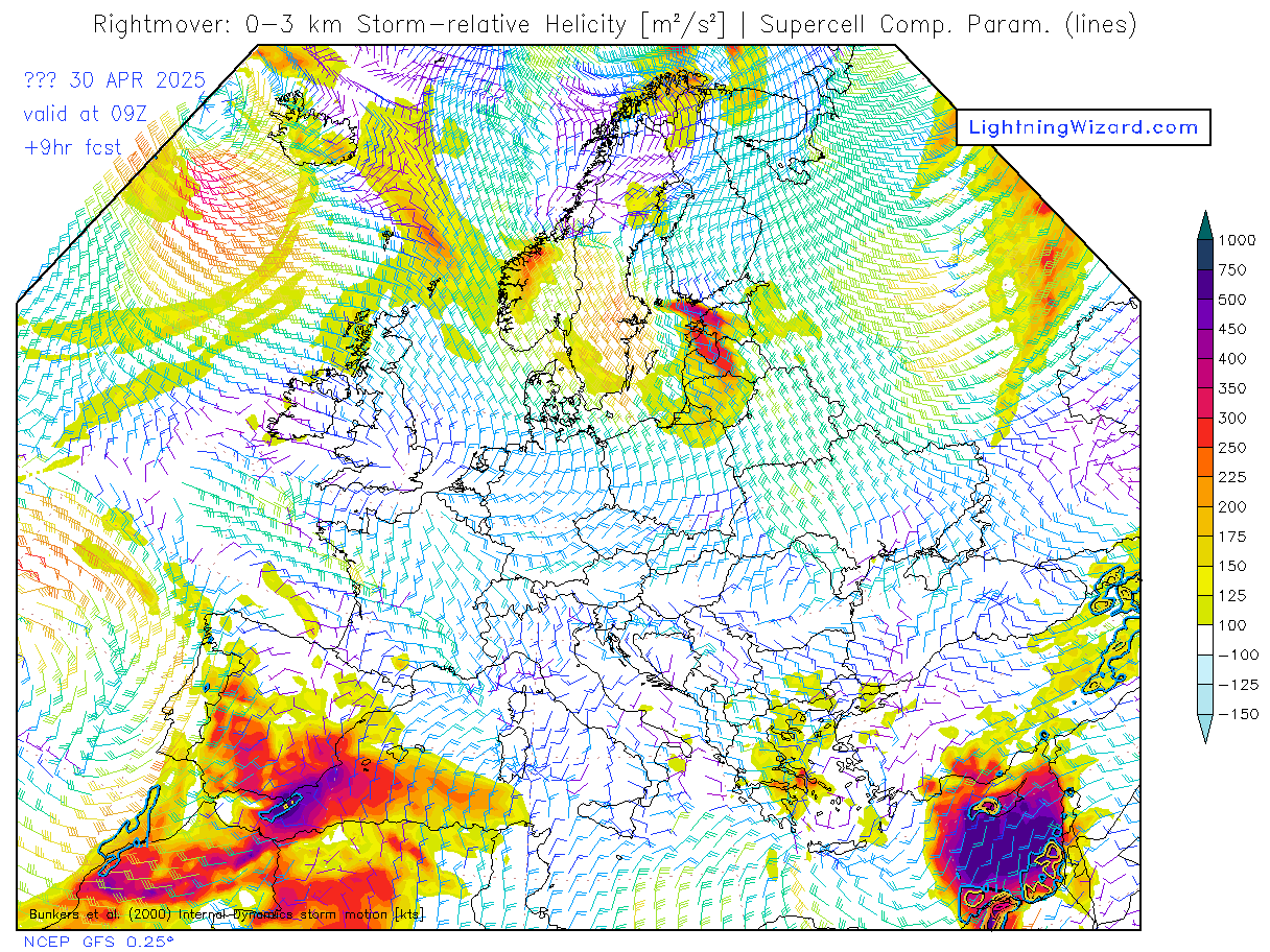
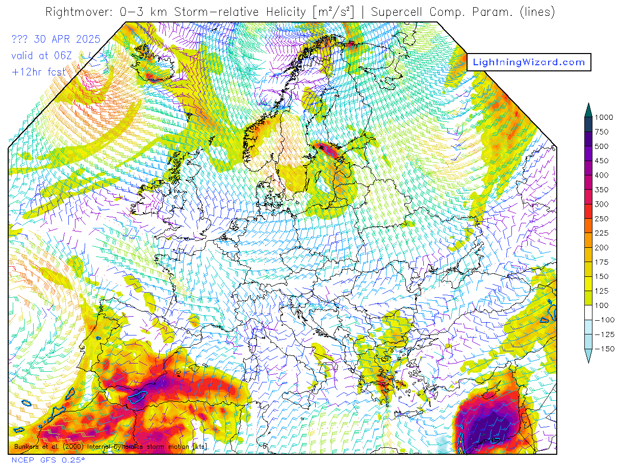
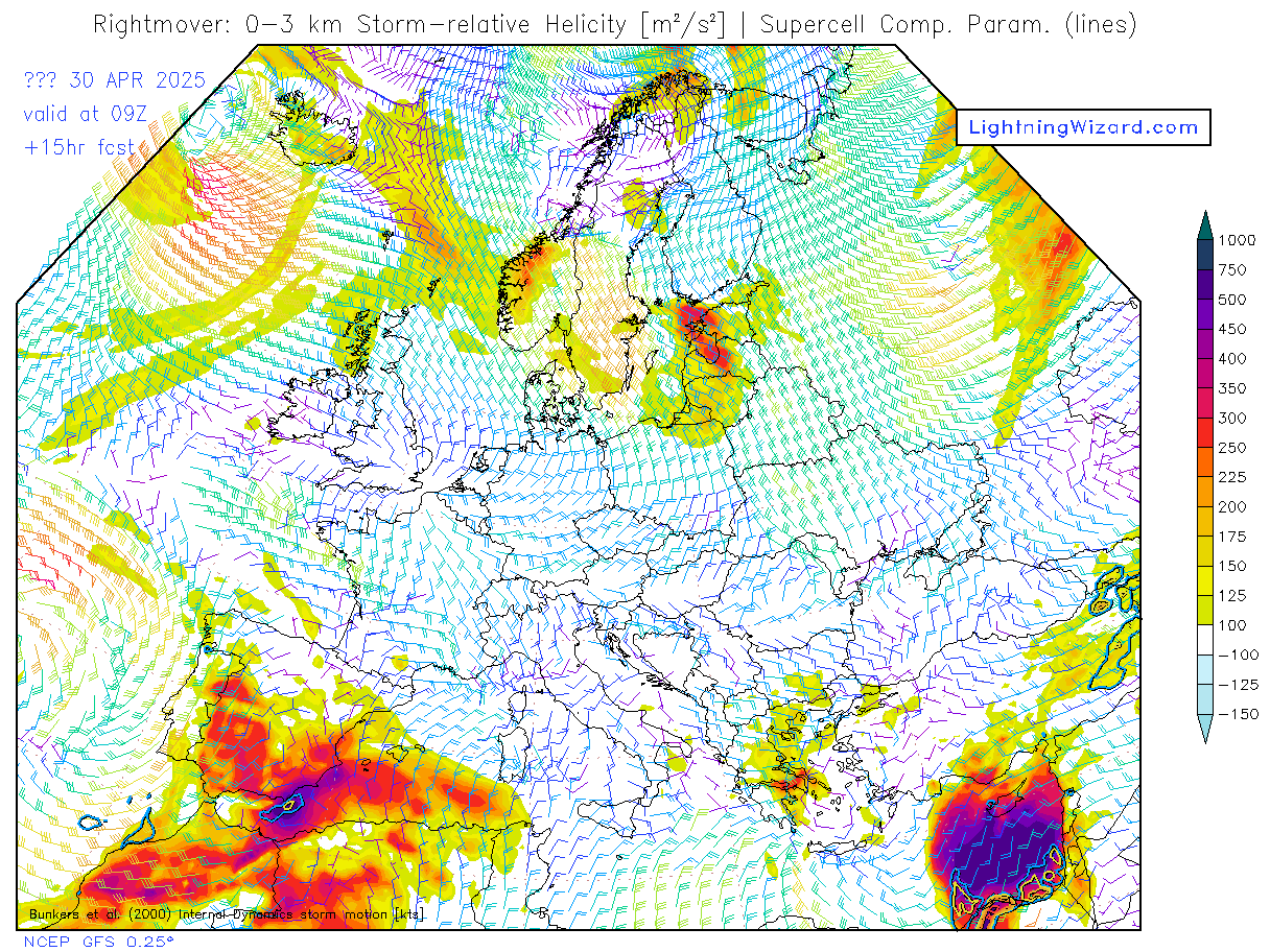
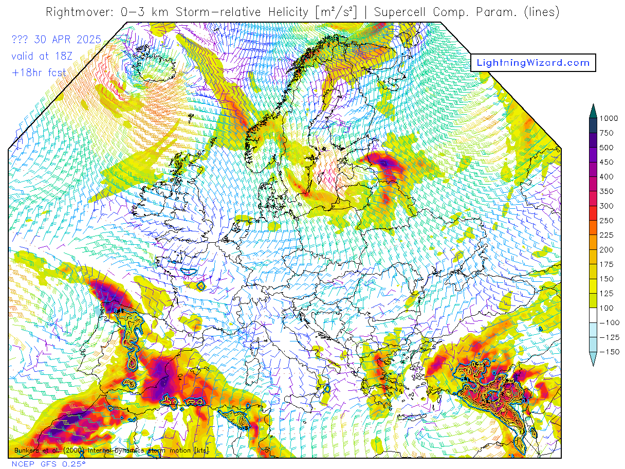
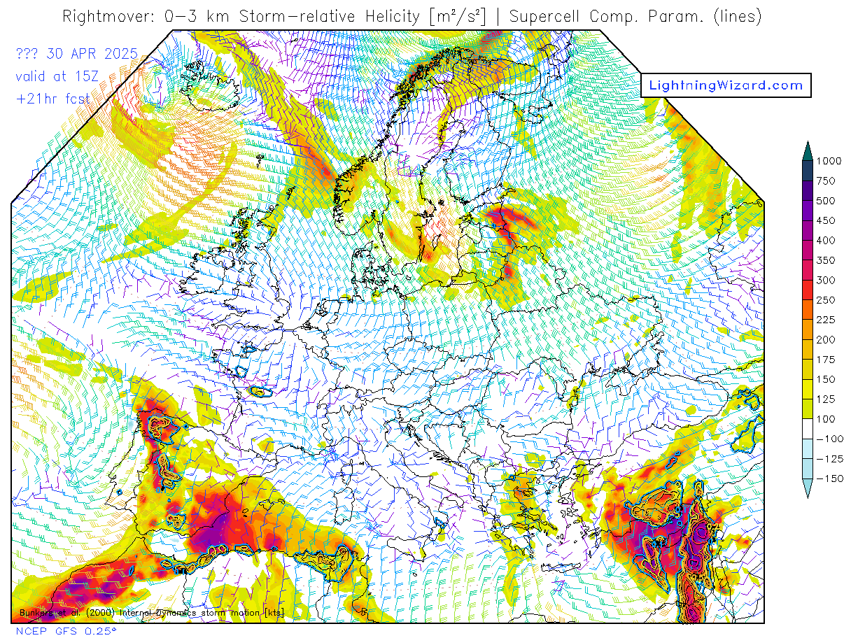
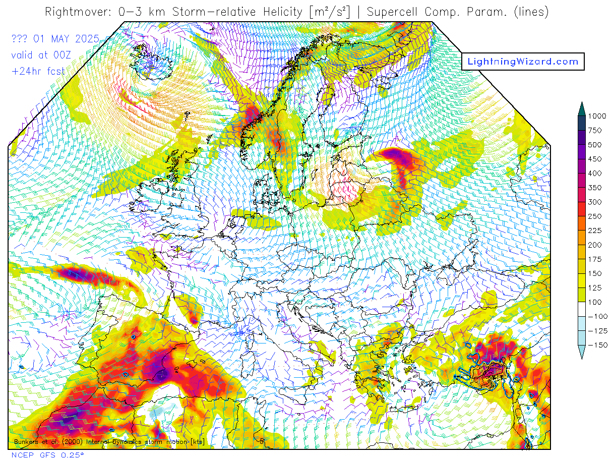
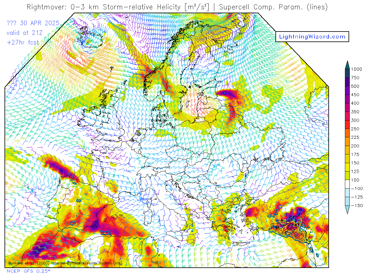
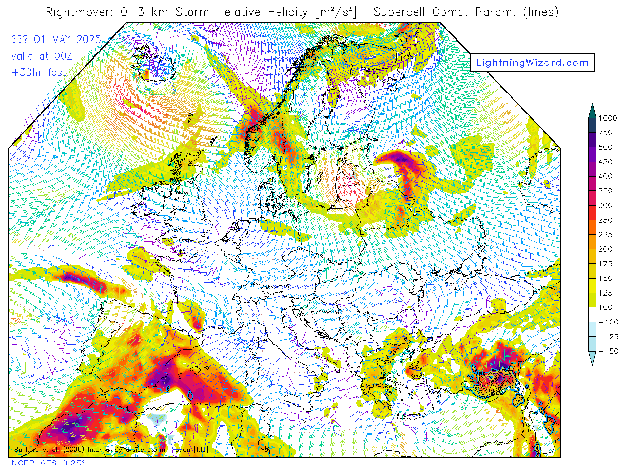
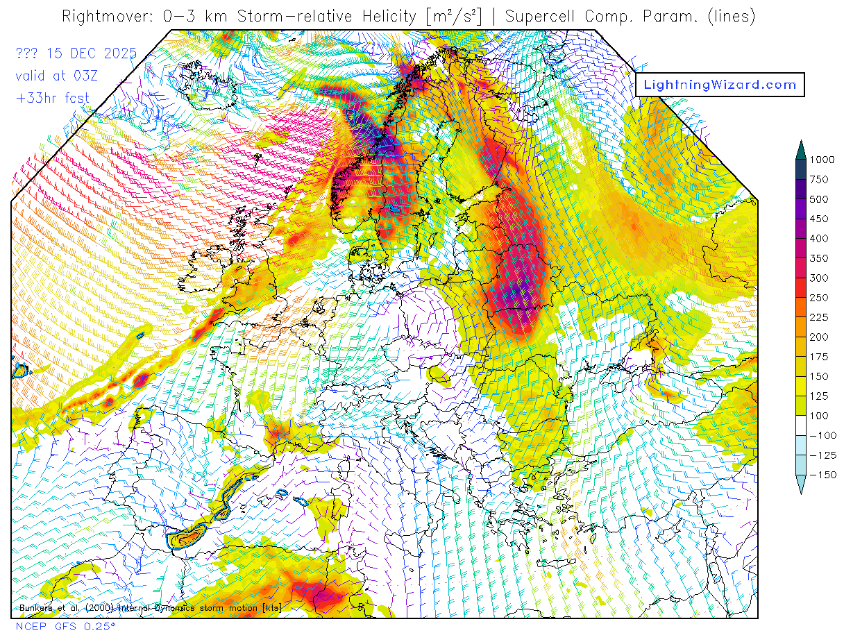
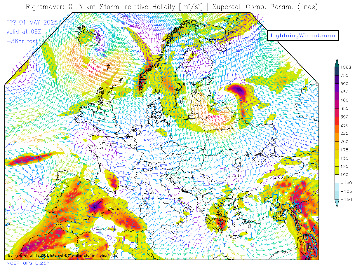
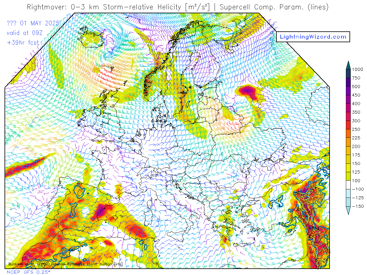
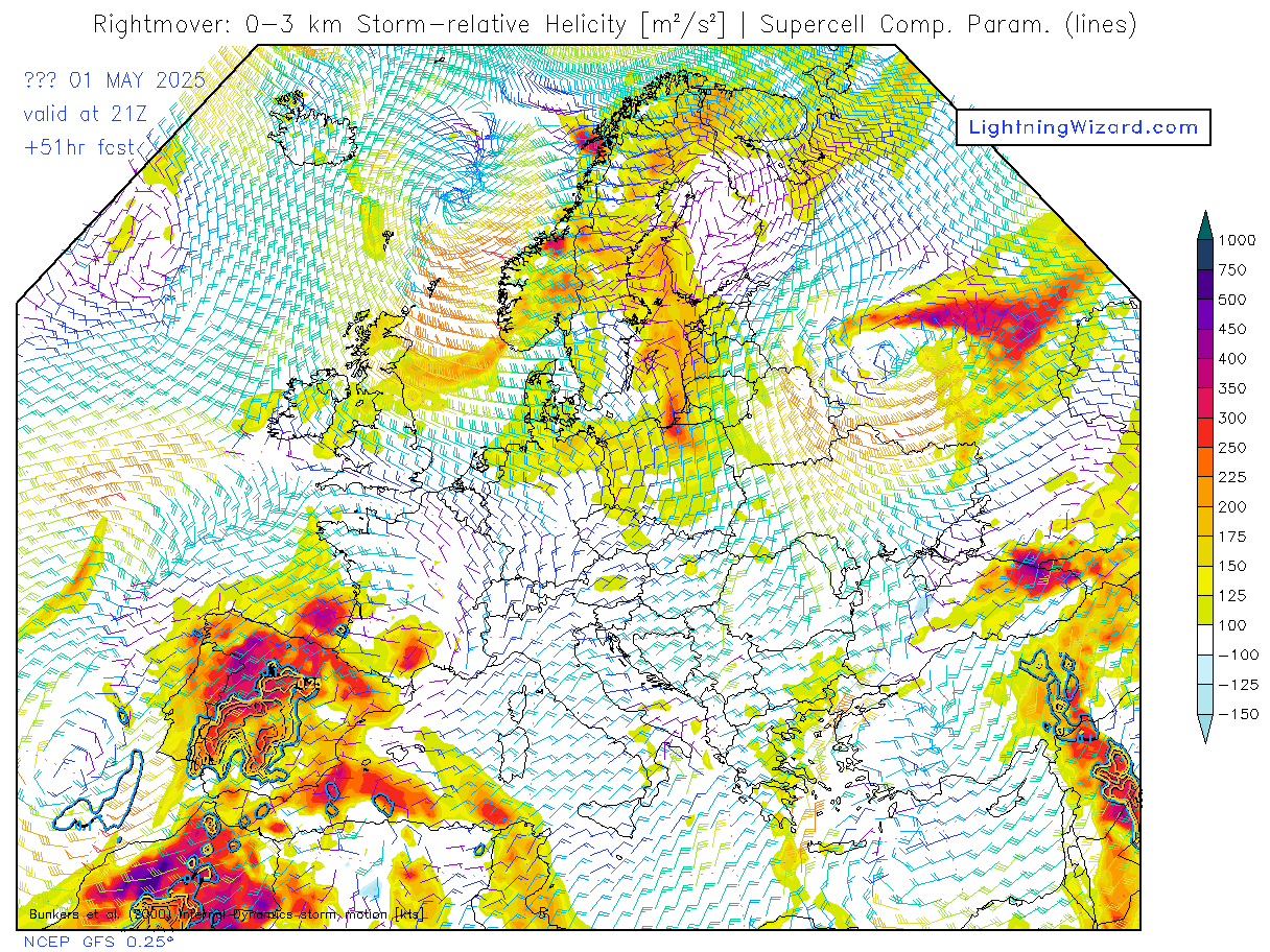
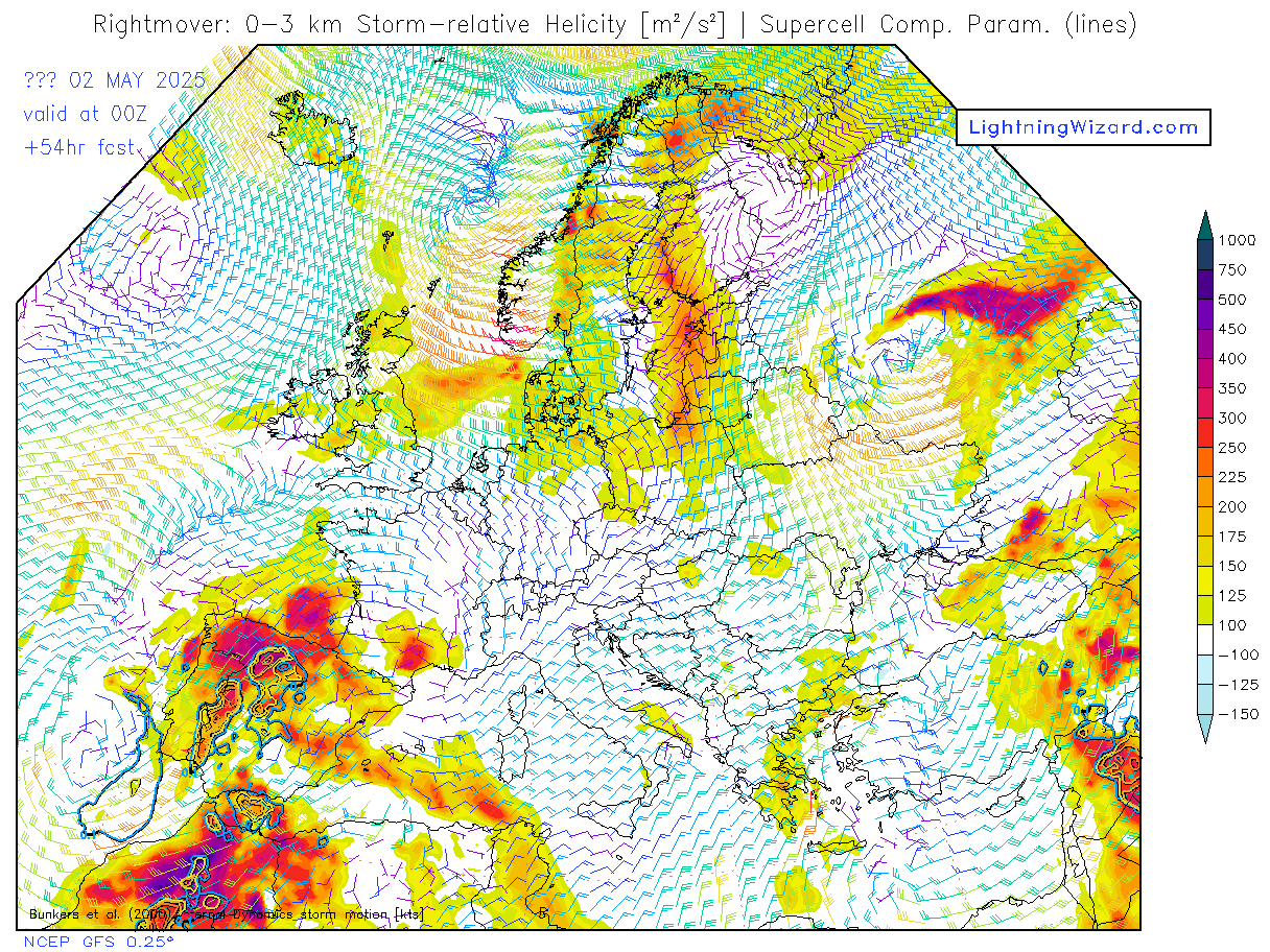
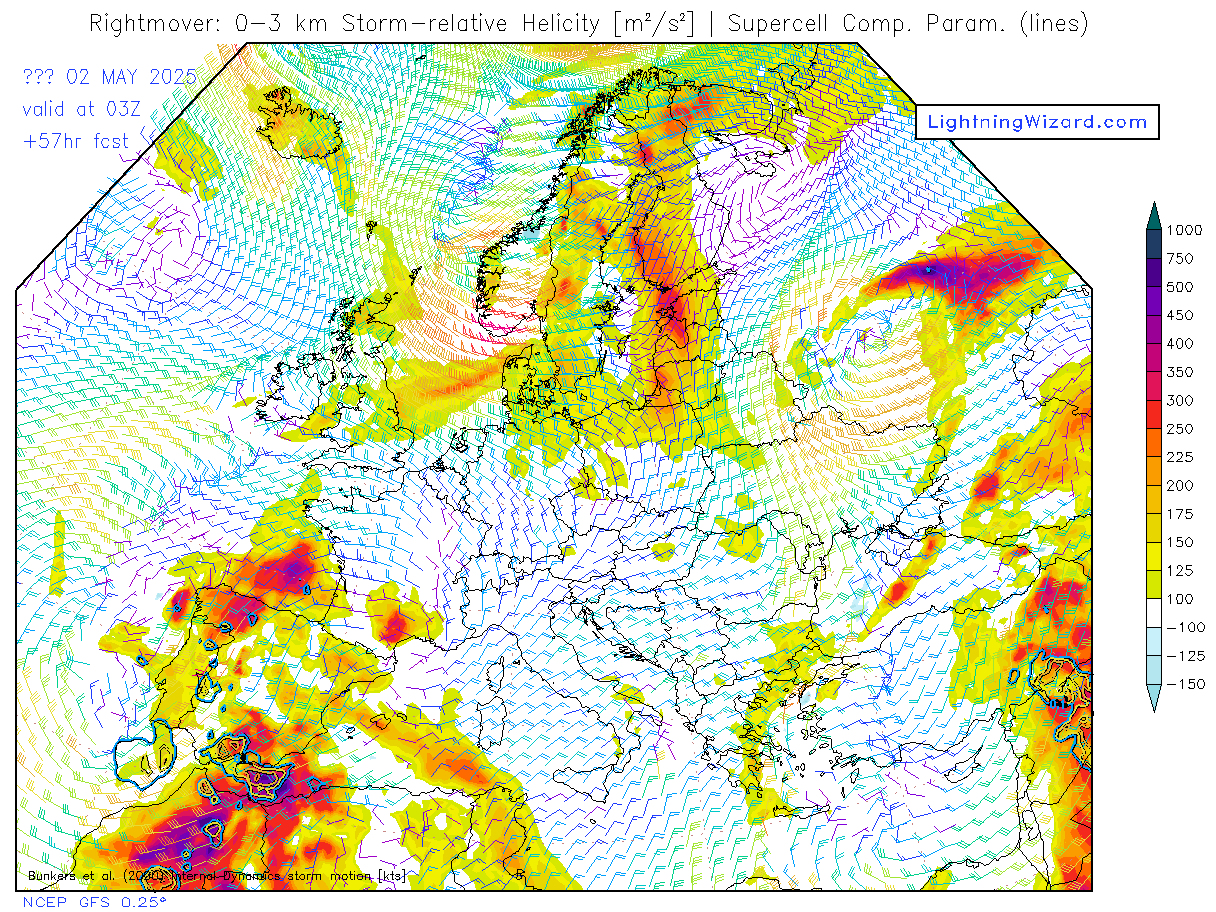
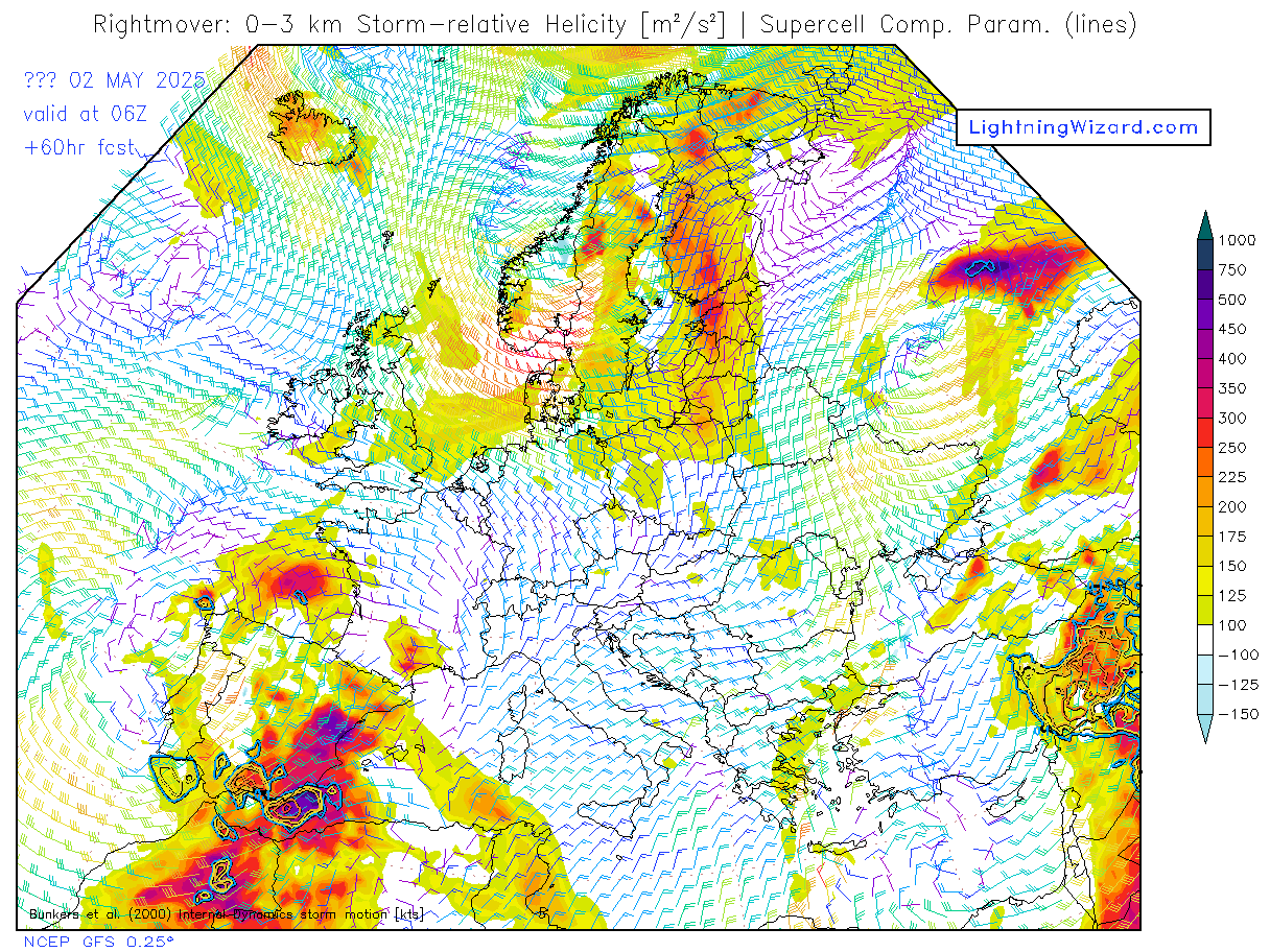
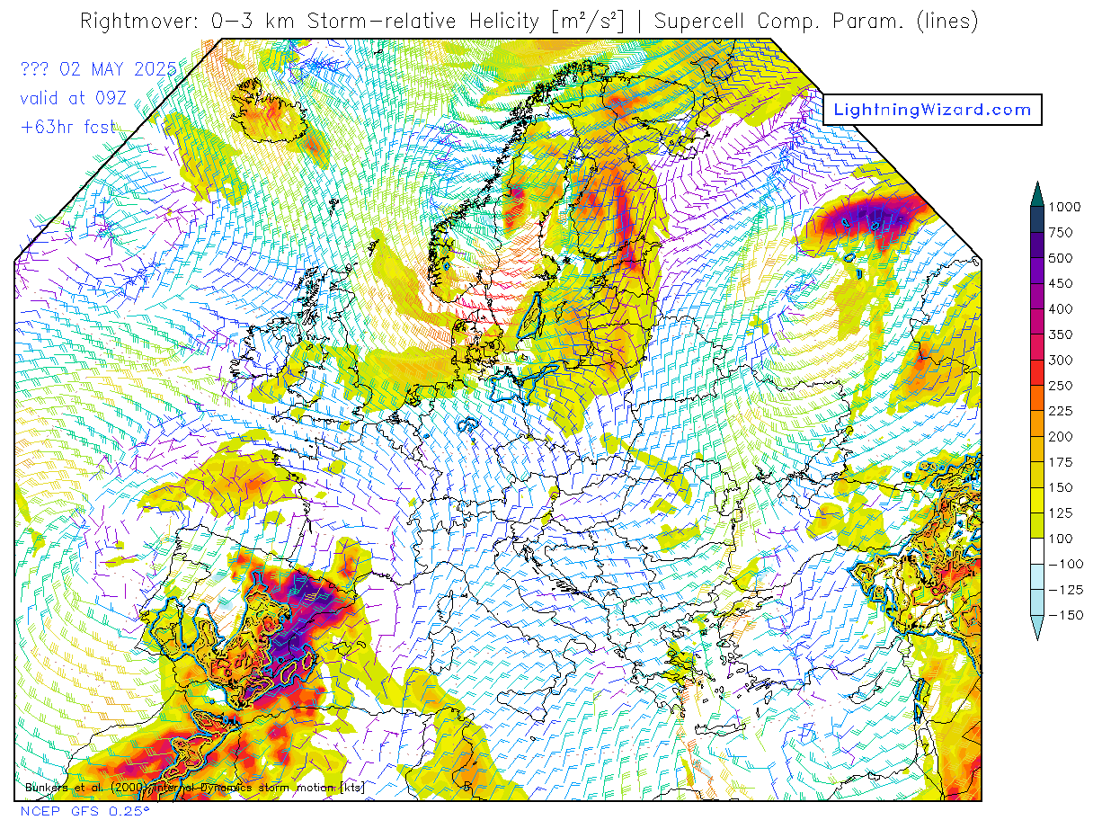
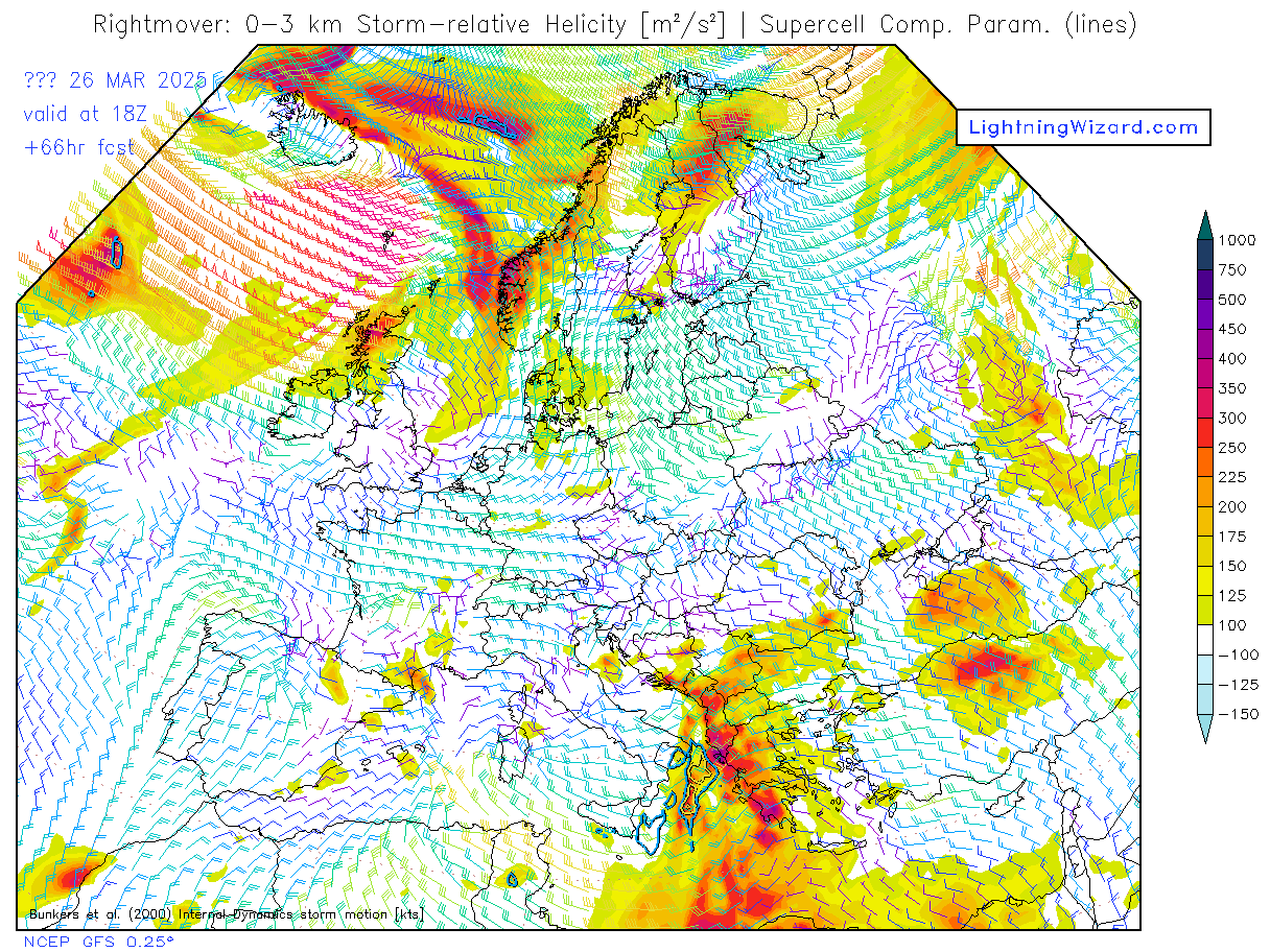
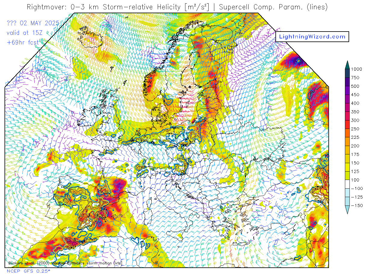
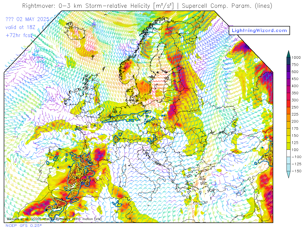
Helicity (HEL) is a mathematical
quantity derived from: 1.
speed shear (how much wind speed increases with
height) between the surface and 3 km above, 2.
directional shear (how much wind speed changes
direction with height) between the surface and 3 km
above, 3. The strength of the low level wind
directly into the speed and directional wind shear.
The stronger each of these components is the higher
the helicity.
source: source:www.theweatherprediction.com
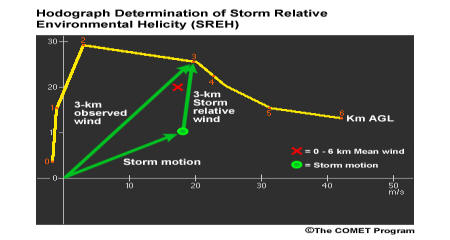
When we compute
helicity, it is most appropriate to use
storm-relative winds. To find the
storm-relative wind, we subtract the
anticipated or observed storm speed and
direction from the wind at every level of
the sounding. This process requires a
hodograph analysis of the wind profile to
predict the storm motion. Several methods
have been proposed to determine supercell
storm motion. Currently the most accepted
approach is the ID method. Generally, storms
in an environment with a clockwise-curving
hodograph will move to the right of the 0-6
km mean wind, while storms in an environment
with a counterclockwise curving hodograph
will move to the left.
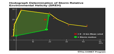
Automated sounding routines such as the
interactive skew-T compute SREH from the
hodograph. On the hodograph, SREH is
proportional to the area swept out by the
storm relative wind vector over the depth of
the inflow, typically 3 km AGL, as depicted
in this figure. SREH values are positive for
right-moving storms, characterized by
clockwise-curving hodographs (as shown here)
and cyclonic rotation, while SREH values are
negative for left-moving, anticyclonic-rotating
storms with counterclockwise-curving
hodographs. |
 |
|