Snow Forecast
|
|
E potent temp
|
Thickness
|
Dew Point Temp
|
Temp 850hPa
|
Temp 500hPa
|

|


|
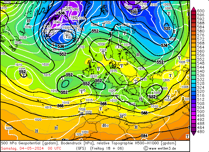
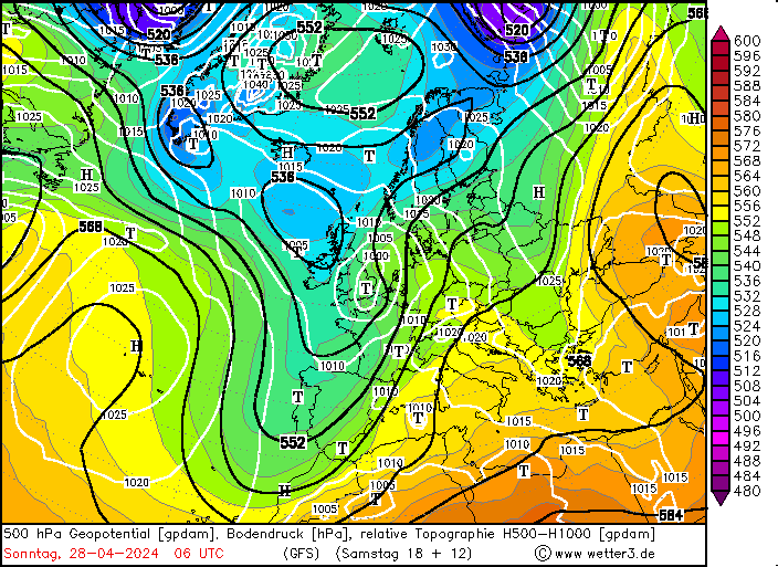
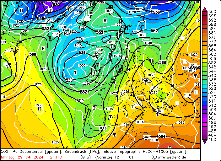
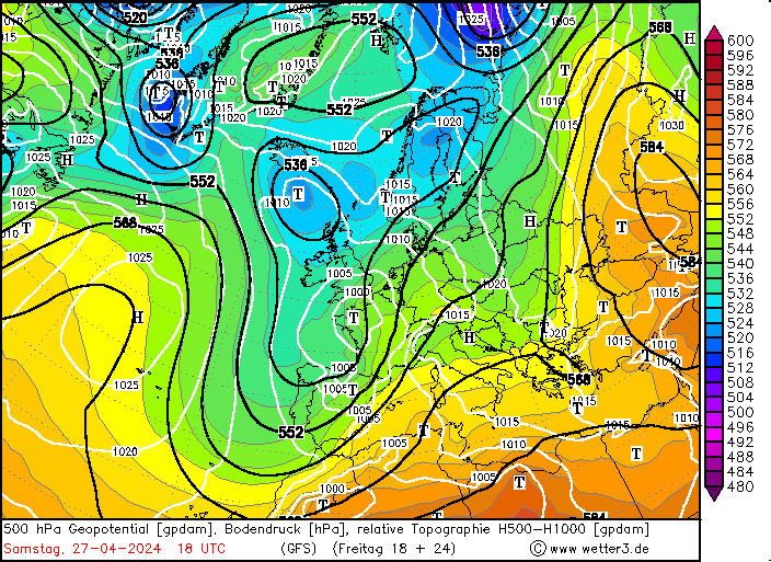
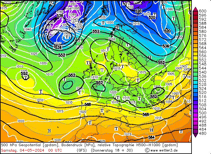
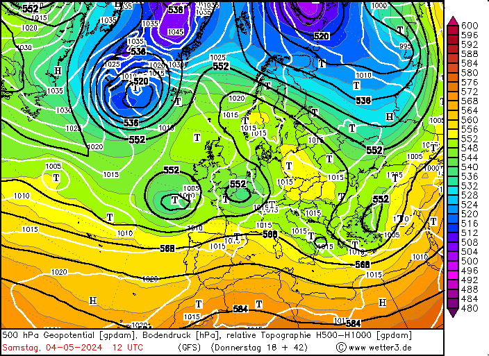
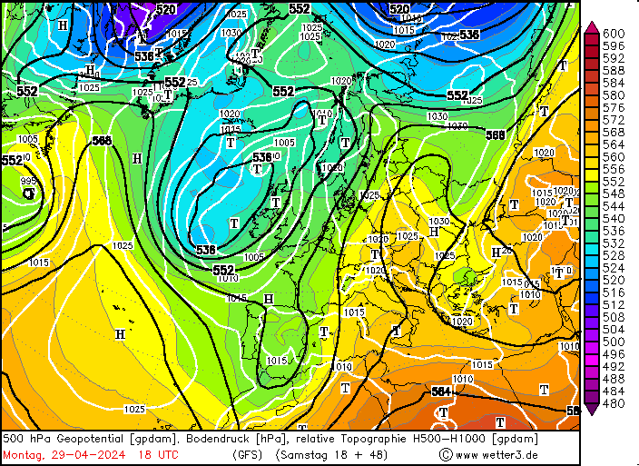
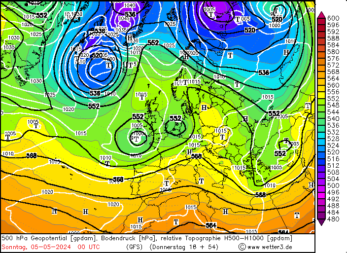
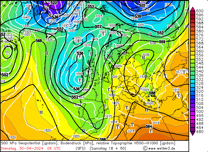
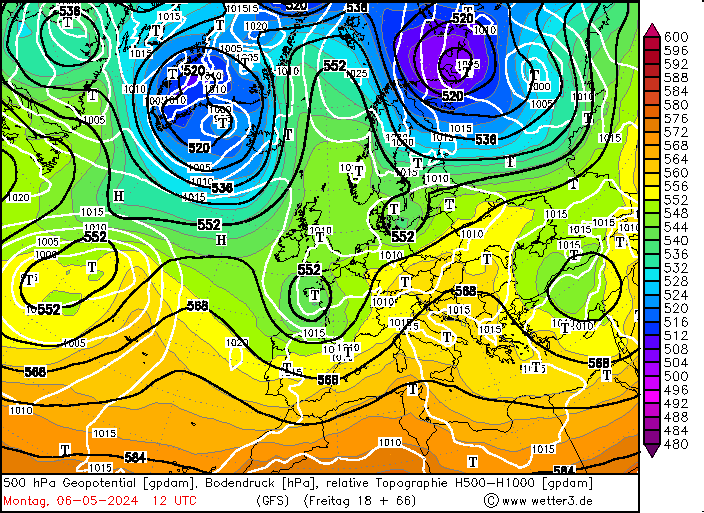
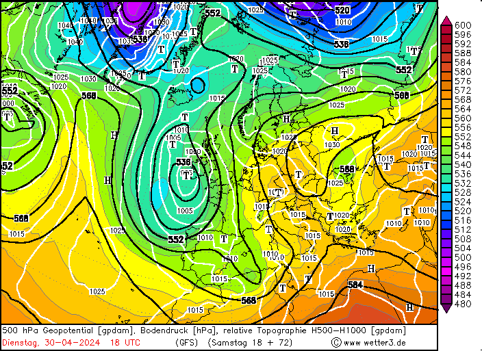
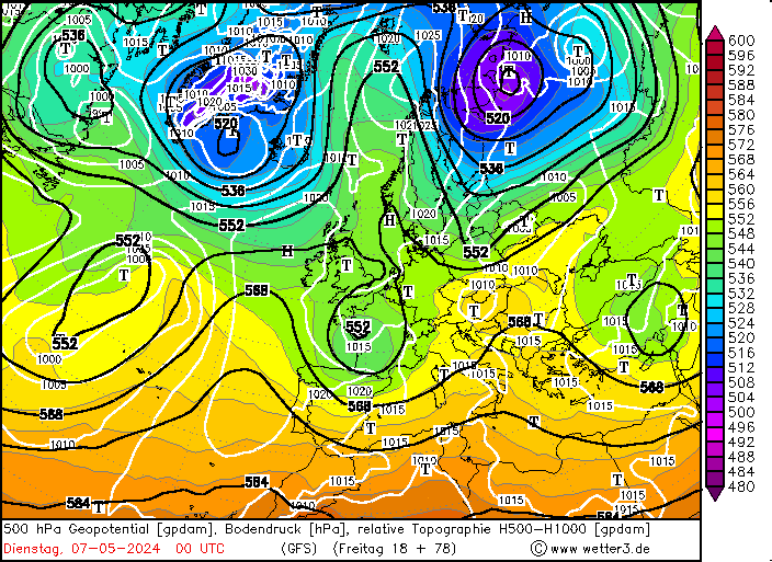
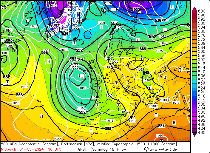
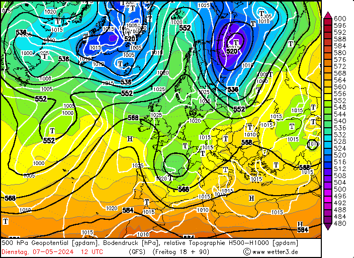
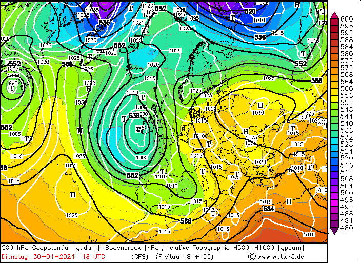
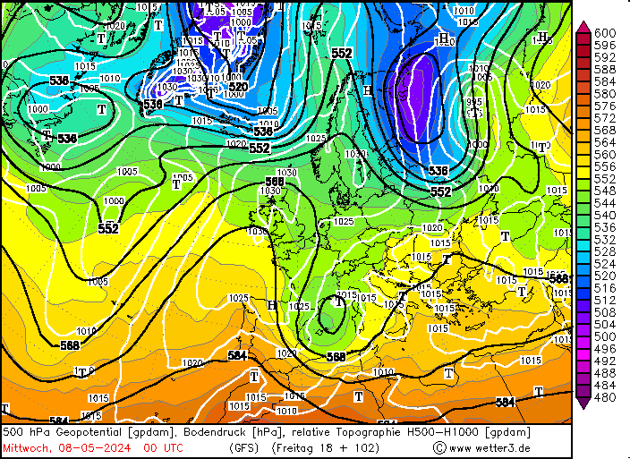
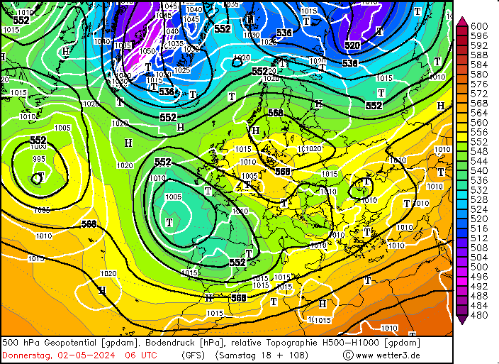
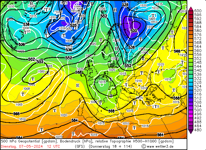
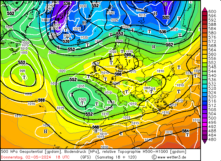
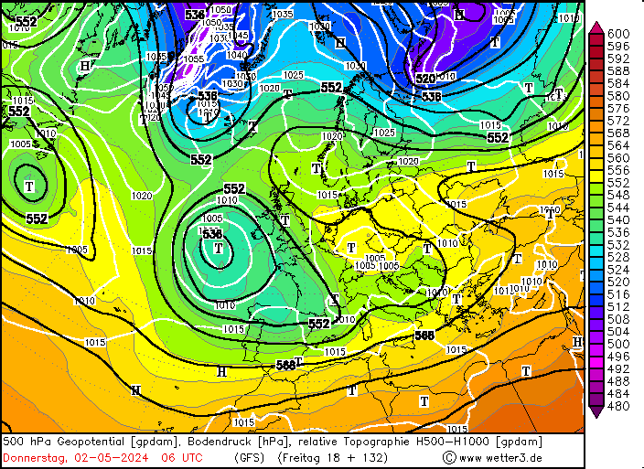
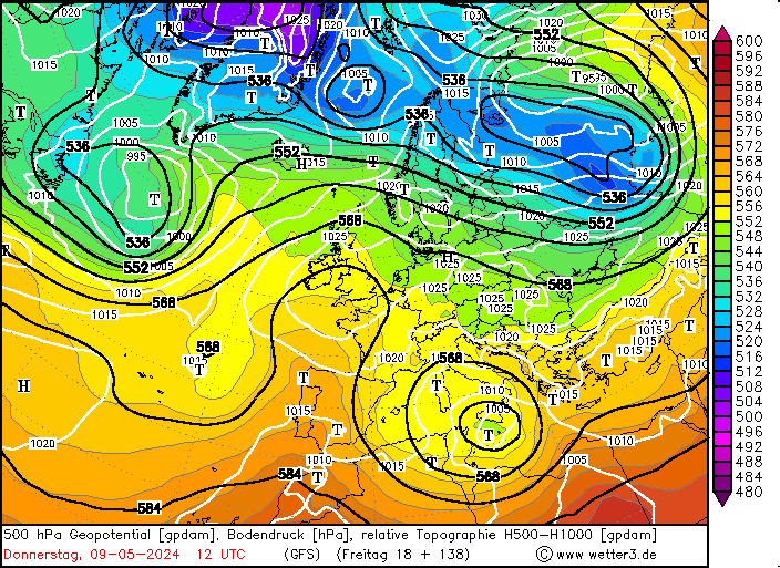
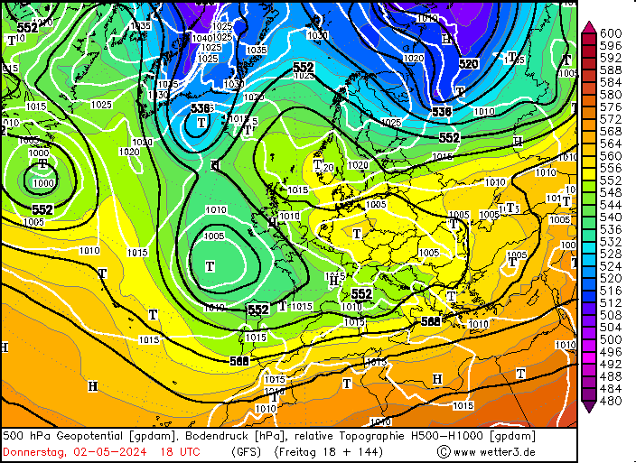
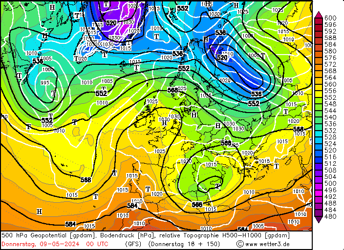
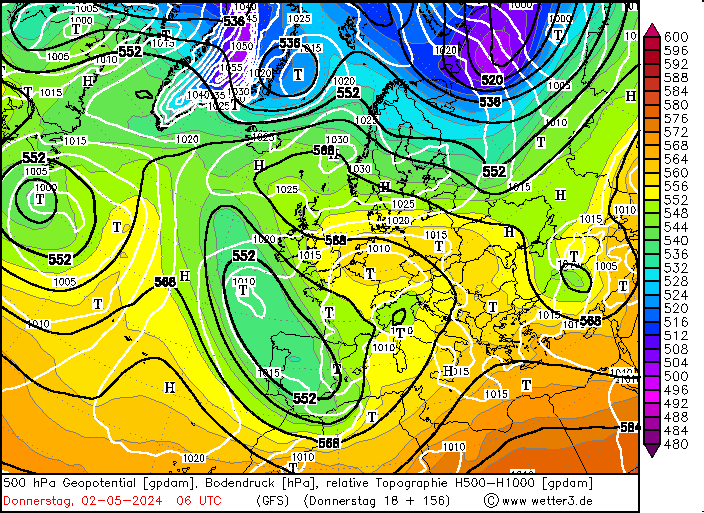
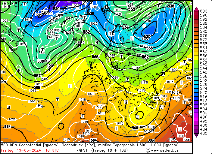
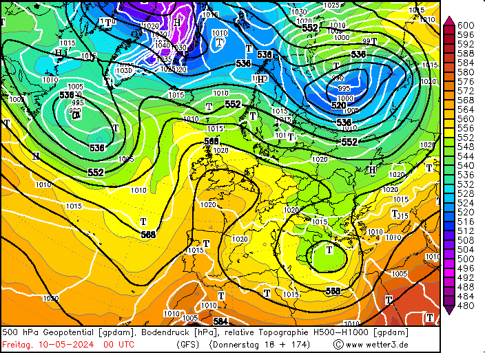
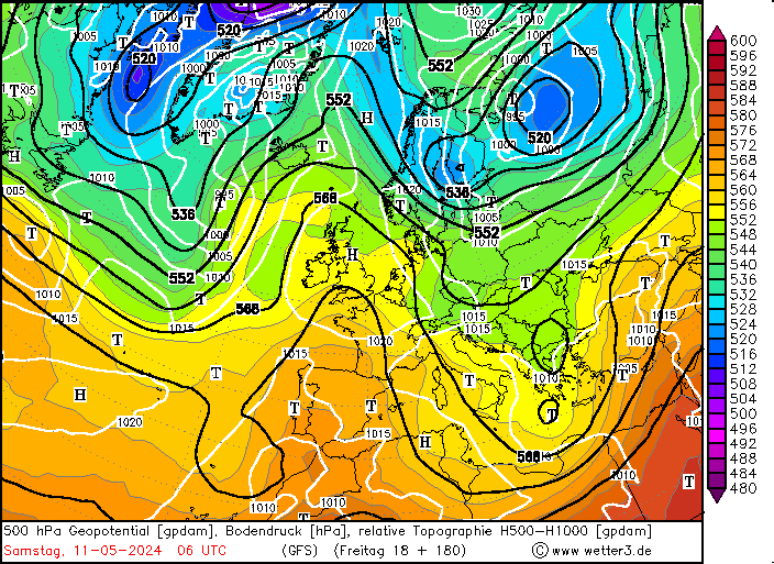
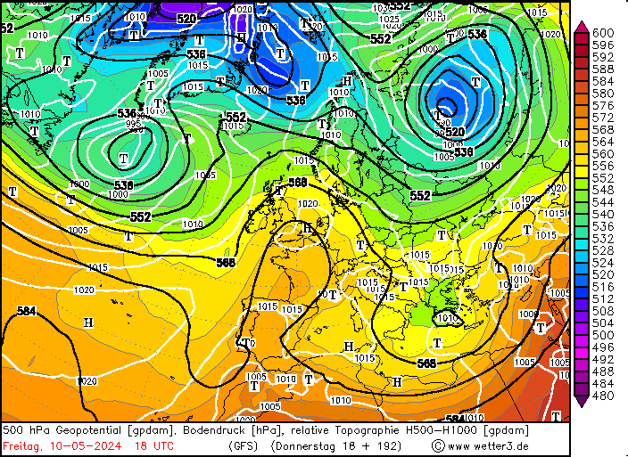
White lines: MSLP isobars (units = hPa / interval = 5 hPa) Dark grey/dash & double-dot lines: thickness isopleths for the layer (500-1000) hPa. (units = dekametres [dam] / interval = 18 dam) Colour shading: colour coded as at scale by diagram. (units = dam / interval = 4 dam). Orange/Red high values - blue/indigo etc., low values. Black line: the 552 dam contour (of the 500 hPa surface) - highlighted as the approx. median value to trace major troughs/ridges in pattern. |
|
Some critical values for thickness if precipitation is expected (table of Murray-1959). Over Low Countries (< 300m):
Legend
SOURCE:http://www.skystef.be
|
|
|
|
|
SOURCE:http://www.theweatherprediction.com http://www.crh.noaa.gov/lmk/soo/docu/precip_type.php